Routes up
Snowdon routes: 11 ways to the top
Llanberis PathHiking · 6.9 km one way · 979 m ascent · ~3h 0m · from LlanberisModerate
A long, steady path beside the railway to the summit.
Start 127 m6.9 km to the top Start grid ref SH 580 594 · Driving directions · By bus or trainNear the start
- Y Gwynedd0.6 km
- Sports Bar0.7 km
- The Heights0.8 km
- Penceunant Isaf0.2 km
- Platform Grill0.4 km
- Llygad Yr Haul0.6 km
- Public toilets0.4 km
- Public toilets0.6 km
- Public toilets0.9 km
- Llwyn Celyn bach0.8 km
From OpenStreetMap, within 2 km. Check opening times before you rely on them.
Pyg TrackHiking · 5.3 km one way · 740 m ascent · ~2h 20m · from Pen y Pass car parkModerate
A rocky path from Pen y Pass round the side of Crib Goch to Bwlch Glas.
Start 367 m5.3 km to the top Start grid ref SH 646 556 · Driving directions · By bus or trainNear the start
From OpenStreetMap, within 2 km. Check opening times before you rely on them.
Miners' TrackHiking · 6.8 km one way · 770 m ascent · ~2h 40m · from Pen y Pass car parkModerate
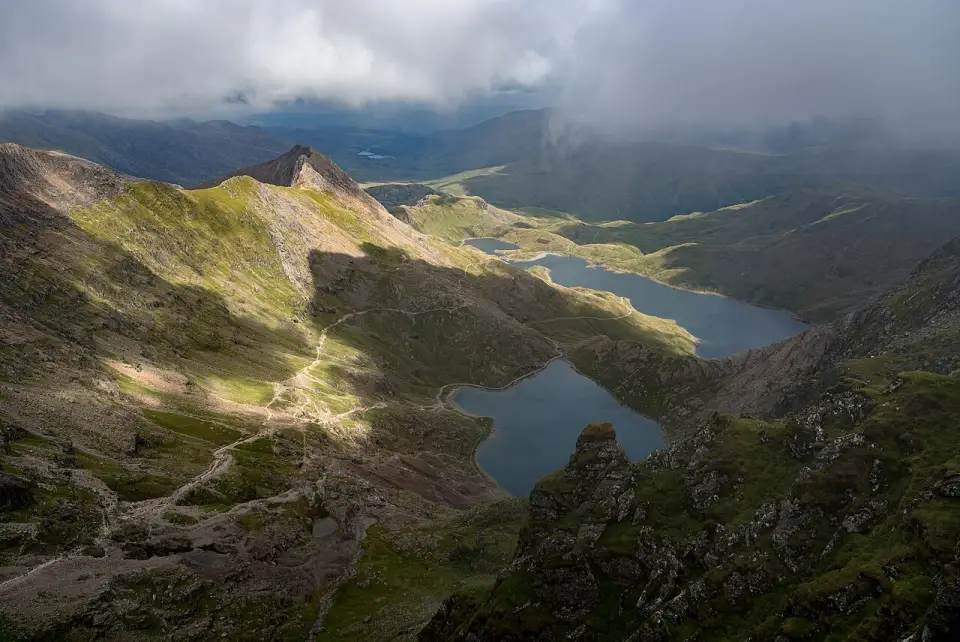
A wide track past Llyn Teyrn, Llydaw and Glaslyn, then a steep, loose climb to join the Pyg Track below Bwlch Glas.
Start 367 m6.8 km to the top Start grid ref SH 646 556 · Driving directions · By bus or trainNear the start
From OpenStreetMap, within 2 km. Check opening times before you rely on them.
Rhyd Ddu PathHiking · 5.9 km one way · 900 m ascent · ~2h 40m · from Rhyd Ddu station car parkModerate
A quieter path from the west with views over the Nantlle Ridge. The final section runs along the narrow Bwlch Main ridge.
Start 191 m5.9 km to the top Start grid ref SH 570 526 · Driving directions · By bus or trainNear the start
- Cwellyn Arms0.3 km
- Tŷ Mawr0.3 km
- Public toilets0.1 km
- Public toilets1.4 km
- Public toilets1.5 km
- Cwellyn Arms Campsite1.5 km
From OpenStreetMap, within 2 km. Check opening times before you rely on them.
Snowdon Ranger PathHiking · 6.4 km one way · 940 m ascent · ~2h 50m · from Llyn Cwellyn car park (Snowdon Ranger)Moderate
One of the oldest paths up, zig-zagging from Llyn Cwellyn and then climbing beside the cliffs of Clogwyn Du'r Arddu.
Start 150 m6.4 km to the top Start grid ref SH 564 550 · Driving directions · By bus or trainNear the start
From OpenStreetMap, within 2 km. Check opening times before you rely on them.
Watkin PathHiking · 6.5 km one way · 1,015 m ascent · ~3h 0m · from Pont Bethania car park, Nant GwynantHard
The biggest climb of the main paths, from near sea level past waterfalls and old quarries. The last stretch up the summit cone is steep, loose scree.
Start 76 m6.5 km to the top Start grid ref SH 627 505 · Driving directions · By bus or trainNear the start
From OpenStreetMap, within 2 km. Check opening times before you rely on them.
South Ridge (Allt Maenderyn)Hiking · 6.5 km one way · 900 m ascent · ~2h 50m · from Rhyd Ddu station car parkHard
Leaves the Rhyd Ddu Path for the quieter south ridge over Allt Maenderyn, then climbs the narrow, exposed crest of Bwlch Main to the summit.
Start 191 m6.5 km to the top Start grid ref SH 570 526 · Driving directions · By bus or trainNear the start
- Cwellyn Arms0.3 km
- Tŷ Mawr0.3 km
- Public toilets0.1 km
- Public toilets1.4 km
- Public toilets1.5 km
- Cwellyn Arms Campsite1.5 km
From OpenStreetMap, within 2 km. Check opening times before you rely on them.
Crib GochScrambling · 5.1 km one way · 880 m ascent · ~2h 30m · from Pen y Pass car parkScramble
A grade 1 scramble along a knife-edge arête, then over Crib y Ddysgl to the summit. Very exposed. Not a place to be in strong wind, rain or ice.
Start 366 m5.1 km to the top Start grid ref SH 646 556 · Driving directions · By bus or trainNear the start
From OpenStreetMap, within 2 km. Check opening times before you rely on them.
Y Lliwedd traverseScrambling · 7.0 km one way · 723 m ascent · ~2h 35m · from Pen y Pass car parkScramble
From Pen y Pass over the cliffs of Y Lliwedd and Bwlch y Saethau to the summit: a grade 1 scramble with big drops on the north side. More climbing than the 723 m net figure, with re-ascents along the ridge.
Start 366 m7.0 km to the top Start grid ref SH 646 556 · Driving directions · By bus or trainNear the start
From OpenStreetMap, within 2 km. Check opening times before you rely on them.
Fox's Path and Crib Goch North RidgeScrambling · 6.5 km one way · 723 m ascent · ~2h 30m · from Pen y Pass car parkScramble
A faint, exposed approach with serious route finding, then the grade 1 North Ridge onto Crib Goch's knife-edge crest. For experienced scramblers in dry, calm weather only. Extra re-ascents beyond the 723 m net figure.
Start 366 m6.5 km to the top Start grid ref SH 646 556 · Driving directions · By bus or trainNear the start
From OpenStreetMap, within 2 km. Check opening times before you rely on them.
Crib Goch North Ridge from Blaen y NantScrambling · 5.3 km one way · 903 m ascent · ~2h 35m · from Blaen y Nant, Llanberis PassScramble
A remote approach up Cwm Glas to the grade 1 North Ridge and the Crib Goch crest. Very exposed, with no easy way off once on the ridge.
Start 181 m5.3 km to the top Start grid ref SH 620 569 · Driving directions · By bus or trainNear the start
From OpenStreetMap, within 2 km. Check opening times before you rely on them.