
UK Mountains
Summit forecasts, walking routes, cloud inversion odds and dark sky scores for every peak in England, Wales, Scotland and Northern Ireland.
Highest first · 5,912 summits
UK mountains 168–141 m
-
5801
168 m551 ft
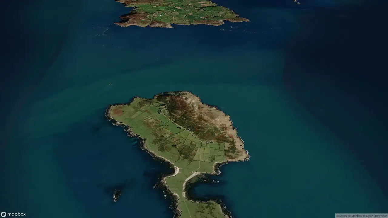
Mynydd Enlli
Anglesey and the Lleyn Peninsula -
5802
168 m551 ft
Normanby Top
The River Tees to The Wash 11° / 7°Overcast
InvCloud inversion chance —
DarkDark sky score —
-
5803
168 m551 ft
Soroba Hill
Oban to Loch Fyne 10° / 6°Dense drizzle
InvCloud inversion chance —
DarkDark sky score —
-
5804
167 m548 ft
Penlan Voss
South-West Wales 12° / 7°Partly cloudy
InvCloud inversion chance —
DarkDark sky score —
-
5805
167 m548 ft
Sheriff Hill
North Pennines -
5806
167 m548 ft
White Down
South West England
12° / 4°Overcast
InvCloud inversion chance —
DarkDark sky score —
-
5807
166 m545 ft
Beinn Bheag Deas
North Uist, South Uist and Nearby Islands
10° / 8°Moderate drizzle
InvCloud inversion chance —
DarkDark sky score —
-
5808
166 m545 ft
Cruach Sleibhe
Mull and Nearby Islands
10° / 8°Dense drizzle
InvCloud inversion chance —
DarkDark sky score —
-
5809
166 m545 ft
Pen y Moelfre
South-West Wales
12° / 8°Partly cloudy
InvCloud inversion chance —
DarkDark sky score —
-
5810
164 m538 ft
Bwrdd Arthur
Anglesey and the Lleyn Peninsula -
5811
164 m538 ft
Cairn Fell
Carrick and Galloway
12° / 9°Light drizzle
InvCloud inversion chance —
DarkDark sky score —
-
5812
164 m538 ft
Cliffe Hill
South East England
15° / 9°Overcast
InvCloud inversion chance —
DarkDark sky score —
-
5813
164 m538 ft
Corstorphine Hill
Firth of Forth to the River Tweed
12° / 8°Light drizzle
InvCloud inversion chance —
DarkDark sky score —
-
5814
164 m538 ft
Failand Hill
South Central England
12° / 8°Partly cloudy
InvCloud inversion chance —
DarkDark sky score —
-
5815
164 m538 ft
High Hunsley Wold
The River Tees to The Wash
13° / 7°Overcast
InvCloud inversion chance —
DarkDark sky score —
-
5816
163 m535 ft
Dunan Mor
Cape Wrath Peninsula
10° / 6°Light drizzle
InvCloud inversion chance —
DarkDark sky score —
-
5817
163 m535 ft
Oaken Head
Lancashire, Cheshire and S Pennines -
5818
163 m535 ft
Warton Crag
Lancashire, Cheshire and S Pennines
11° / 8°Light drizzle
InvCloud inversion chance —
DarkDark sky score —
-
5819
162 m531 ft
Barone Hill
Loch Fyne to Bute and the Firth of Clyde
11° / 6°Moderate drizzle
InvCloud inversion chance —
DarkDark sky score —
-
5820
161 m528 ft
Hill of Clibberswick
Shetland Islands
9° / 6°Dense drizzle
InvCloud inversion chance —
DarkDark sky score —
-
5821
161 m528 ft
Stoke Hill
South West England 13° / 4°Fog
InvCloud inversion chance —
DarkDark sky score —
-
5822
159 m522 ft
Arnside Knott
Lake District S
10° / 5°Light drizzle
InvCloud inversion chance —
DarkDark sky score —
-
5823
159 m522 ft
Vord Hill
Shetland Islands
10° / 8°Light drizzle
InvCloud inversion chance —
DarkDark sky score —
-
5824
158 m518 ft
Cleit Niosaboist
Harris and Nearby Islands
10° / 8°Light drizzle
InvCloud inversion chance —
DarkDark sky score —
-
5825
158 m518 ft
Glastonbury Tor
South Central England
15° / 8°Overcast
InvCloud inversion chance —
DarkDark sky score —
-
5826
158 m518 ft
Hill of Hamarsland
Shetland Islands
10° / 8°Dense drizzle
InvCloud inversion chance —
DarkDark sky score —
-
5827
158 m518 ft
Hill of Miffia
Orkney Islands
10° / 7°Light drizzle
InvCloud inversion chance —
DarkDark sky score —
-
5828
157 m515 ft
Suidhe Chatain
Loch Fyne to Bute and the Firth of Clyde
11° / 6°Moderate drizzle
InvCloud inversion chance —
DarkDark sky score —
-
5829
155 m509 ft
Bedham Hill
South East England
12° / 3°Overcast
InvCloud inversion chance —
DarkDark sky score —
-
5830
155 m509 ft
Churchdown Hill
Central and Eastern England
14° / 8°Light drizzle
InvCloud inversion chance —
DarkDark sky score —
-
5831
155 m509 ft
Gometra
Mull and Nearby Islands 10° / 8°Slight rain
InvCloud inversion chance —
DarkDark sky score —
-
5832
155 m509 ft
Oliver's Mount
England Region 37
13° / 8°Light drizzle
InvCloud inversion chance —
DarkDark sky score —
-
5833
154 m505 ft
Crogearraidh na Thobha
North Uist, South Uist and Nearby Islands
10° / 6°Light drizzle
InvCloud inversion chance —
DarkDark sky score —
-
5834
154 m505 ft
Maol Domhnaich
Barra to Barra Head
10° / 9°Light drizzle
InvCloud inversion chance —
DarkDark sky score —
-
5835
153 m502 ft
Greeny Hill
Orkney Islands
10° / 8°Light drizzle
InvCloud inversion chance —
DarkDark sky score —
-
5836
152 m499 ft
Penglais
Aberystwyth to Welshpool
12° / 8°Overcast
InvCloud inversion chance —
DarkDark sky score —
-
5837
152 m499 ft
The Verne
South Central England
13° / 11°Overcast
InvCloud inversion chance —
DarkDark sky score —
-
5838
150 m492 ft
Moyle Hill
The Glenkens to Annandale
12° / 9°Moderate drizzle
InvCloud inversion chance —
DarkDark sky score —
-
5839
149 m489 ft
Sliabh Meadhonach
Canna, Rhum and Eigg
12° / 8°Light drizzle
InvCloud inversion chance —
DarkDark sky score —
-
5840
147 m482 ft
Burebhal
North Uist, South Uist and Nearby Islands
10° / 9°Moderate drizzle
InvCloud inversion chance —
DarkDark sky score —
-
5841
147 m482 ft
Tennyson Down
South East England 14° / 9°Mainly clear
InvCloud inversion chance —
DarkDark sky score —
-
5842
146 m479 ft
Caitiosbhal
Lewis and Nearby Islands
11° / 7°Moderate drizzle
InvCloud inversion chance —
DarkDark sky score —
-
5843
146 m479 ft
Meall nam Meallan
Loch Maree to Loch Broom
10° / 6°Moderate drizzle
InvCloud inversion chance —
DarkDark sky score —
-
5844
145 m476 ft
Ashley Hill
South East England
13° / 7°Clear sky
InvCloud inversion chance —
DarkDark sky score —
-
5845
144 m472 ft
Beacon Hill
South West England
14° / 13°Slight rain showers
InvCloud inversion chance —
DarkDark sky score —
-
5846
144 m472 ft
Meall na h-Araid
Loch Torridon to Loch Maree
10° / 5°Moderate drizzle
InvCloud inversion chance —
DarkDark sky score —
-
5847
143 m469 ft
Carnan Eoin
Jura, Scarba and Colonsay
13° / 8°Light drizzle
InvCloud inversion chance —
DarkDark sky score —
-
5848
143 m469 ft
Crussa Field
Shetland Islands
10° / 8°Light drizzle
InvCloud inversion chance —
DarkDark sky score —
-
5849
141 m463 ft
Beinn Bhreac
Minginish and the Cuillin Hills
11° / 7°Moderate drizzle
InvCloud inversion chance —
DarkDark sky score —
-
5850
141 m463 ft
Carnan Mor
Coll and Tiree
12° / 8°Moderate drizzle
InvCloud inversion chance —
DarkDark sky score —
- Excellent 70+
- Good 50+
- Fair 30+
- Poor
- Not scored today
How to read it
Summit weather, not valley weather
Every forecast here is for the summit's height. Air cools about 6.5 °C per 1,000 m and ridge wind is often double the valley's, so a 12° day in Llanberis can feel close to freezing on Yr Wyddfa.
Cloud inversion
The chance of standing above a sea of cloud at sunrise. Read more on cloud inversions.
Dark sky
0–100 from cloud, moonlight and light pollution. 70+ is a night worth staying up for. Grey tiles haven't been scored in the last 36 hours.
Highest mountain in each nation
| Nation | Mountain | Height |
|---|---|---|
| Scotland | Ben Nevis | 1,345 m · 4,413 ft |
| Wales | Yr Wyddfa (Snowdon) | 1,085 m · 3,560 ft |
| Ireland | Carrauntoohil | 1,039 m · 3,407 ft |
| England | Scafell Pike | 978 m · 3,209 ft |
| Northern Ireland | Slieve Donard | 850 m · 2,789 ft |
Where the data comes from
Forecasts blend the Met Office UKV, ECMWF, ICON and GFS models via Open-Meteo, corrected to each summit's height. Light pollution comes from NASA VIIRS night-time satellite data.
Questions
UK mountain questions
What is the highest mountain in the UK?
Ben Nevis, 1,345 m (4,413 ft). Wales: Yr Wyddfa, 1,085 m. England: Scafell Pike, 978 m.
What is a cloud inversion?
Cold air trapped in the valleys under warmer air, so cloud fills the valleys and summits stand clear above it. Most likely on calm, clear autumn and winter mornings.
How is a summit forecast different?
It's calculated for the top, not the nearest town, so it accounts for the colder air and stronger wind you'll meet up there.
How often is it updated?
Every morning for the UK's higher summits, and whenever a mountain page is opened, from the Met Office UKV, ECMWF, ICON and GFS weather models.